Monday 2nd July – Fleets Dam – There were further warning of flooding over the weekend. Areas around Doncaster, Bentley and Tollbar in particular, have been underwater for a number of days now. In the event, the heavy rain forecast was less that expected, but had the effect of keeping me in most the weekend. It is interesting to note that Daniel Defoe wrote in about 1720:-
A Tour Through England and Wales Vol II (Pub J.M. Dent 1928)
There is a large tipper lorry unloading a load of soil beside several similar mounds in the car park. A JCB is building a substantial bank between the River Dearne and the lake at the point the water has poured over. Both water-aerators are now in the corner of the lake. A Grey Heron still uses one as a perch despite its changed position. Three Great Crested Grebes are diving. A Garden Warbler sings from the hedges. The scene seems fairly peaceful now after the days of flooding. By mid-morning it is raining heavily again.
Wednesday 4th July – Wombwell Ings – The flood channel has been opened and the water has returned to nearly its normal level. Indeed, except for the “tide-mark” of debris, it is hard to see any trace of the flooding. The Mute Swans are on the far side of the ings. A number of holes are visible in the bank walls along the River Dearne – I wonder how many voles and possibly Kingfishers have been flooded out? Hopefully, any young will have been able to leave the burrows before they were submerged. Skylarks are singing overhead, rather disjointed and tuneless songs. Swifts are sweeping down across the river. Twittering Goldfinches fly over. Ragwort is in flower – I wonder if any Cinnabar Moths have laid any eggs and whether they survived the soaking, there are no signs of larvae.
Home – At the weekend Dill the Dog chewed the base of her tail raw. I put a “bucket” over her head to stop her causing any more harm. The vet has cleaned it up and given her some injections and tablets. She is feeling very sorry for herself.
Thursday 5th July – Banks Hall – A road runs around between the main Barnsley - Holmfirth road and the lane from Cawthorne to Silkstone. At a sharp bend is the end of the Benthill Hill Lane I wandered up on 19th June this year. It is narrow and very muddy, so I retreat rather quickly to the loud chip call of a Great Spotted Woodpecker, and turn up a lovely Beech lined avenue towards Banks Hall. A fine wrought iron fence runs along the avenue with wrought iron field gates between old stone pillars. A Curlew keens overhead and drops down into a field. The road turns at the private entrance to the Hall. Beside the road to the farm is a large walled garden with inverted arches on the bottom wall. The lower part of the garden is now a tarmacadamed yard but the upper section is still being used as a kitchen garden. The footpath leads round the bottom of the extensive formal gardens of the Hall, which is a splendid Georgian country house. Charles Tiplady Pratt MA, vicar of Cawthorne, writing in the 1870s in his “History of Cawthorne”, states the Hall was previously called Micklethwaite or The Bank. It was the seat of one of the branches of the Greene family. Pratt records, “The Banks estate was sold about the middle of last century to Mr. Fawkes of Farnley, and was added by purchase to the Cannon Hall estate in 1826. Banks Hall has in the present century been the residence of Mr Thomas Wilson, Mr. Richard Thorp, and Mr. Thomas Ridley, of Northumberland, who tried the experiment of “gentleman-farming” there without much success. It was during the eleven years that it was occupied by Mr. Thomas Wilson, a man of conspicuous taste and ability, son of Mr. Daniel Wilson, of Barnby Furnace, that the grounds were laid out in their present form. After the heavy losses he suffered through unsuccessful mining operations, he was for many years connected with the Aire and Calder Navigation Company.” The house, which may now be a nursing home, has wonderful views over Banks Bottom, a valley with a strip of wood running along the bottom, and up towards Hoylandswaine. Swallows swoop over golden barley. The wheat has not fared so well, large patches have been flattened.
Home – Since yesterday I had been able to remove the “bucket” from Dill the Dog’s head, but this afternoon she has another go at her tail so I have had to replace it, much to her disgust.
Monday 9th July – East Ardlsey – A village some three miles north of Wakefield, lying to the west of the M1 and south of the M62 motorways. It was developed on coal and some woollen weaving. The village is long and thin, lying in a north-south orientation. The oldest part lies on top of a hill with the Old Hall being the most distinguished building. The earliest part of the building dates from 1622 with later additions in 1632 and more over the next thirty years. A Grade II listed building in sandstone with ashlar dressings, it was restored in 1998. Beside and behind are some splendid old outbuildings of the same sandstone with thick stone tile roofs. Arthur Mee, in his “The King’s England – West Riding”, records the tale of James Nayler of East Ardsley, born in 1616. Mee states “He fought for the Parliament and became a Quaker. His preaching was declared to be blasphemous, and after being whipped and pilloried in London he had his tongue bored and his forehead branded. He was whipped again and imprisoned for two years, and in 1660 he was set upon by highwaymen who robbed him of his money and cudgelled him so that he died soon after.” He goes on to say, “He himself was unbalanced in his mind and apparently impossible, but his sufferings were appalling.”
Heading north the road passes a new primary school with the old school opposite now a very large pile of hardcore. There are a lot of nice Victorian houses and terraces, although any space in between them has and is being filled by modern houses. Dropping down Fall Lane, the “Morley Industrial Co-operative Society Ld.” looks down the lane, but is now a household. St Gabriel’s Mission Church was built in 1889 at a cost of £1,557. The attached Sunday Schools were built in 1877 and enlarged in 1897. At the bottom of the hill is the railway line and a site, known as “The Fall” since at least the early 1700s, consisting of a relatively new woodland, which was developed on the sites of three former heavy industries (coal mining, steel works and railway sidings) in the mid 1970s. The woodland is part of the “Forest of Leeds”. On the other side of the railway in both directions are construction sites for new housing. Beyond, towards the M1, are fields of rhubarb as this area lies in the famous Yorkshire Rhubarb Triangle. Back up the hill, rows of Victorian terraces lead off eastwards, each consisting of some fifty dwellings. The vast majority have been modernised into pleasant little homes, with small yards out the back and greens between the rows. Some strips of the original cobbled roadway remains along with the Yorkshire flagstone pavements.
Dewsbury – Normally, I visit Dewsbury only to go to Savile Town where Mulluco’s Asian Supermarket sells just about everything imaginable for cooking the cuisine of the Indian subcontinent. However, today I head into the centre of the town first. Dewsbury has not suffered brutal “modernisation” of its centre that was inflicted on towns such as Barnsley and Pontefract in the mid 20th century. There are some pretty dire modern buildings around and some relatively sympathetic new areas, but many of the huge Victorian edifices remain, albeit in a number of cases, in a desperate condition. One massive mill, Cloth Hall Mills, has been restored into flats. The Machell Brothers, William and Robert, moved their Mungo and Shoddy manufacturing business from Bradford Road to this mill in 1874. Busts of the brothers, along with Disraeli and Richard Cobden adorn the wall outside the entrance to the mill. Nearby, the Central Stores of the Dewsbury Pioneers Industrial Society Ltd has fared less well and now stands derelict. This magnificent building was designed by Holtom and Fox and opened in 1880. Departmental shops were housed on the ground floor; offices, a library and conversation rooms were on the first floor and a large industrial hall seating 1500 on the second floor. Around one of the upper floor windows is a decoration containing a depiction of a beehive, a symbol of success through toil. Behind this building is another tall, four storey edifice that tapers back at a sharp angle. Down the street are two arcades, Kingsway and Queensway, built in the early 20th century. Up a side street stands the Telephone Exchange, built in the same pale brown sandstone as the Victorian buildings, but with a decidedly art deco feel about it. Around the corner is No. 4 Grove Street, built as an auction house around 1870, before becoming a dance hall. It was then taken by Luke Howgate, a funeral furnisher, in the 1920s. Busts of Mr Fox, the auctioneer and Dr George Fearnley, the first mayor of Dewsbury are on the wall. Some of the street here are still cobbled with stone rather than tarmacadamed. Back towards the main road is the Longcauseway United Reform Church, the third consecrated building on this site, the first being built by a congregation of independents formed in 1814. The present building was erected in 1882-84 with a fine neo-gothic façade designed by Walter Hanstock of Batley.
Tuesday 10th July – Holme Valley – As I drive through New Mill, I see that the Moorbrook Mill is being demolished. I head over the hill and into the village of Scholes. The name Scholes is Norse and means “temporary huts”. Parking in a newish housing estate, a path takes me into a warren of old weavers’ cottages. The road is more a track of crushed stone. The track leads out into the main street, where there is a Post Office and pub. One house has a coal shute cover in the wall made by Timothy Wood Ltd of Huddersfield, possibly over one hundred years ago. The road drops down to Lee Mills, which are now a combination of industrial units and “luxury” apartments. A track leads off past a large Victorian house which would have belonged to the mill owner or higher manager and then through fields. A young Rook stands on a drystone wall flicking its wings in a demand for food, which its parent obliges. Meadow Brown butterflies rest on brambles. The scut of a rabbit flashes white as it disappears through the long grasses of a meadow. The path comes to the edge of a wood, which according to the 1854 map is called Dobroyd. Here it drops steeply down between two walls. Far below is a large pond. Stone pillars with a hole drilled through stand down the path – I assume they once carried a railing. There are some very high steps down which are worrisome as they are damp. Over the wall is a stone bank that has been covered with dressed stone. This is falling away and the holes in the bank from rabbit warrens. A Great Spotted Woodpecker calls from the tall Beeches.
At the bottom of this narrow valley is a rickety bridge over the river, Dean Dike. There is a weir above the bridge and stone block channels below it. The path is now paved with stone and rises steeply through woods called Kemps. The stones are slippery and at the top is a very steep set of steps. Dill the Dog takes several attempts to get up them. Old steps which would have been either side of a gate, now missing, on the footpath leading to Dobroyd Woollen Mill and Jacksons Bridge, make a good resting spot. A Chiffchaff is singing in the trees below. A Chaffinch flies into the trees up here on top of the valley and lets out a burst of song. Magpies cackle and Blue Tits dash in and out of the tree tops. Carrying on up the path leads to Hepworth. This is another old village that was based on farming and weaving wool. The name means “High Dwelling”. A large house is at the top of the path, a fine mansion with large panels of dark wood. This appears to have been called “Solomon’s Temple”.
Opposite is the Church of the Holy Trinity, built by Revd A.T. Wood. Lord Dartmouth laid the foundation stone on 24th April 1862 and the church was consecrated by the Bishop of Ripon on 16th July 1863. Surprisingly, for these days, the church is open. There are some fine Victorian stained-glass windows. The north end window shows the Baptism of Christ in Jordan, flanked by windows depicting St Philip baptising the Ethiopian and St Paul baptising the jailor. The side window shows St Clement and St Irenaeus. There are modern lobbies here which lead through into the main body of the church. The roof is a fine timber-beamed affair. Windows depicting the saints continue down the sides of the nave – St Augustine, St Ambrose, St Athanasius and St Polycarp. Windows in the transepts show the Virgin and the Resurrection. The alter window shows three scenes, the entry into Bethlehem, the Nativity and John Baptist preaching, “Repent for the Kingdom of Heaven is at Hand”. From the church the lane leads into Hepworth. The village suffered from the plagues of the 16th and 17th centuries. It is said that the Plague of London in 1665 came to Hepworth via cloth sent to Foster Place. Part of the village was barricaded and survived. The village hall has an extension standing on cast iron columns. There is a fine looking pub, The Butchers Arms, which is strangely “closed until further notice”. The Sports and Social Club is in a building that was the school (rebuilt in 1852). I retrace my steps. A road leads east into a hillside of newer housing, whilst westwards the road drops down to Dean Bridge. Old moss covered walls line the road, above banks of Foxgloves and the flat seed pods of Honesty. Dean Dike bubbles under the bridge and the road rises steeply again. Fields are bounded by falling drystone walls. A thin layer of soil covers the rock. Jackdaws are noisy and Swallows swoop low over the turf. The road brings me back into Scholes. The noise of children means it is playtime at the school but the bell starts to ring calling the pupils back to class.
Wednesday 11th July – Rotherham – Across a field of dried Oilseed Rape plants and down into Birch Wood, which lies across the steep slopes of the Collier Brook. The woods were historically part of Rawmarsh Common. The Marriage Settlement of 1557 gave the new couple access to the common and woods for pasturing animals and providing wood for houses, hedges and fires. The common was enclosed in 1781. The wood lies south of the Roman Ridge. At the bottom of the slope is a footbridge across the brook. Sheffield artist Jason Thomson, with the help of children from Rawmarsh Thorogate Junior and Infant School, designed the footbridge based on the mythical “Monster of Birch Wood” and the Viking history of the area. The footbridge was built mainly in weathering steel that will rust at first and then stabilise to form a brown patina. I then moved on to Kilnhurst – a village near the River Don. The Church of St Thomas stands high on the hill overlooking the older part of the village. The more modern housing estates are to the north linking with Swinton. The graveyard contains half a pit winding-wheel with a stone commemorating the Kilnhurst Colliery, 1858 to 1989 – “They Shall Not Be Forgotten”. An impressive monument marks the resting place of Samuel Broadhead, Late Treasurer of the Yorkshire Miners Association who died in 1897. The Yorkshire Miners Association joined with other associations on 26th November 1898 to form the Miners’ Federation of Great Britain, which, in turn, became the National Union of Mine Workers on 1st January 1945. Another grave records the brothers, Ben and James Spencer – Ben was killed at Thryberg Colliery in 1896 and James was drowned at Swinton in 1893.
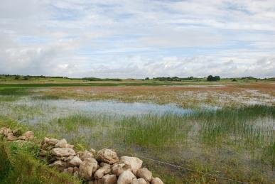
To the east of the original village, is a bridge over a canal loop of the River Don, where there were wharfs and a railway line (the main line runs in a cutting below the church). The name Kilnhurst comes from cyln and hyrst meaning a “wooded hill with a kiln”. There were two potteries here from around 1746, one owned by George Green, and the other Septimus Frost. Further out of the village is the River Don now flowing relatively quietly, although damage and “tide-marks” of the recent flooding can be seen many feet high in the banks and trees. A Garden Warbler is singing in riverside bushes. The road back to Kilnhurst is called Hooton Road, that towards Hooton Pagnell is called Kilnhurst Road – seemingly odd but I suppose it makes a certain sense, By the river is Kilnhurst Ings, the historic floodplain of the river. In the late medieval times the marsh was drained to form meadowland that flooded annually, called Jings. The 1855 OS map shows the area divided into fields for grazing. In the early 1700s, the Spencers built a substantial forge here. The main goight, the culvert returning water to the river is still visible across the ings. By the entrance to the ings is a wooden sculpture by J. Thomson, carved in 1999. The village here has little to recommend it. A large abandoned site sits by the canal, opposite is an industrial estate. There are more boarded-up shops than open ones, indeed even the Chinese Takeaway is shut down! But a new housing development is being constructed a short distance up the canal.
Thursday 12th July – Silkstone – A short path leads past the old village stocks, dating from 1405, outside the Ring o’ Bells pub and up to the bypass, the A628. Over the road, another footpath leads uphill past a splendid farmhouse, Bank House, although it could do with some tender loving care. The path rises across a meadow of sheep with lots of lambs. Beside the path is a steep little valley carrying Hollow Spring. Rooks are feeding across the field and Swallows scythe low for insects. It has been raining and is now very humid. The path enters Silkstone Fall woods. Here it is even damper with water dripping off the trees. A large clump of fungi is growing through the Ivy on a fallen trunk. They are a large and cream variety which I fail to recognise until later, when checking in the field guide I realise they must have been large pale specimens of Oyster Mushroom. A large Field Maple grows beside the path. A large number of Oak saplings have grown out of a short stump, but rot must have set in and they have fallen in all directions, a number across the path and it is a very wet experience ducking under them. A steep set of pressed steel steps takes the path up to the railway line. Dill the Dog only falls over once. Beyond the railway the path crosses a large meadow of tall grasses and emerges on Green Lane at Hall Royd. The lane heads towards Silkstone Common. Modern large houses and bungalows line the lane as it enters the village. The only older buildings here is a short late Victorian terrace. A path leads down to join another which runs into the village one way and under the railway in the other direction. Nearby, ducks are feeding in a yard and a cockerel crows. Under the railway and out into a small lane. A pair of villas, West View 1876/7 look out across the hillside that drops down to the main road. I take a narrow footpath that is getting badly overgrown and, thus very wet. Across the valley is Noblethorpe, which is mainly a single farm. The path joins the road between Silkstone and Silkstone Common. Down the hill to the bottom where a row of cottages have sandbags outside their front doors to guard against any more flooding from Silkstone Beck. Across the road and back into Silkstone where there is a full-sized model of a coal wagon that would have been used on the old Waggon Road.
Friday 13th July – Fleets Dam – It is raining again. The River Dearne is much lower now, hardly any water pours over the raised parts of the weir. The water purifying equipment that had broken free and drifted to the edge of the lake has been removed altogether. The Grey Herons have returned, at least five are on the landing stage, fishing platforms or in the trees.
Kelk Gathering – Off to a little folk festival in the village of Little Kelk, which is a few miles inland from the east coast. It has been raining all day is is still coming down heavily as we set up our tent. It seems daft for both of us to get soaked, so I set the tent up on my own – and soaked I get! It is like a mini-Glastonbury with mud everywhere. The organisers have moved the whole thing into a barn – it is indeed a small festival – which we adjourn to after a couple of warm-up beers. There is a bar selling two excellent local ales and a sing-around in progress. This continues into the night. Kay mentions how this sort of thing, a few people in a barn with some ale, singing songs must have gone on for hundreds of years. A large black beetle scuttles across the floor, and a little later a newt makes slow progress across the ridged concrete.
Saturday 14th July – Kelk Gathering – It has stopped raining. Dill the Dog (who has been discharged by the vet, her tail has healed well) and I head off down the road. Little Kelk is a row of houses down the lane. Maybe half a mile down the road is Great Kelk, a row of houses with a pub and chapel. In between are farms. A small wooden bus shelter has been used by Swallows as a nesting site. All that remains is an empty nest and a pile of droppings at the end of the bench. Greenfinches are in plentiful supply, several wheezing their song and it is pleasing to see several Tree Sparrows in the hedges. Several plum trees in gardens are laden with fruit. The music starts at one o’clock in the afternoon. Various performers produce first class sets – The Flivers are a splendid bunch (with the amazing Digby the Washboard man who was part of a jam session in Robin Hoods Bay last year), The 2 Johns play some very fundamentalist guitar and banjo, quite excellent, Dave and Zöe provide their usual superb set as the penultimate spot to be followed by a barn-storming electric set by the Duncan McFarlane Band.
Tuesday 17th July – Rockley – In the woods stands the Rockley Engine House, a tall castellated building built in 1813 to house a Newcommon Engine which pumped water out of nearby iron workings. The engine was supposed to have been moved to a mine in Chapeltown in 1870. Nearby is a rarity – a blast furnace. The technique of using a strong draught of air produced by a long chimney was introduced from the continent in 1496. The furnace was built sometime between 1698 and 1704 and smelted the local iron ore using charcoal from the woods. Lionel Copley had already built a new blast furnace some 500 yards to the west in 1652. On Lionel Copley’s death in 1675, his furnaces were run by a syndicate. The Fells became important members of the syndicate as did the Spencers of Cannon Hall who became major ironmasters. William Westby Cotton obtained the lease of the forge in 1726 and paid rent to the Earl of Strafford until 1741, when the furnace went out of use. Archaeological evidence shows that coke was used at some stage which may confirm the furnace was brought back into use for a short period in the 1790s. The stack with its inner lining of heat-resistant sandstone blocks remain, but the hearth and outer dressed stone facings have gone. The 1855 OS map shows the furnace standing in Smithy Wood. Warren Dike flows from the Birdwell direction, through the site and into Rockley Dike which flows from Rockley Dam to the west. Next to the stream there used to be a tree that was used by Lesser Spotted Woodpeckers for nesting. The last time I saw it much of the top had rotted away – now there is no sign of it at all. Tall spikes of purple-lipped flowers of Hedge Woundwort grow beside the path. By the stream are the straggly yellow flowers of Marsh Hawk’s Beard.
Over the road is a fine farmhouse on what was Rockley Abbey, which in 1822 was described as “a farm-house in the township of Worsbrough, and parish of Darfield, liberty of Pontefract; 3 miles S. of Barnsley. Anciently a seat of the Rockleys; now belongs to the Wentworths.” Rockley Abbey was never an ecclesiastical site, but originally Rockley Hall. There were two halls for two parts of the Rockley family. In the Domesday Book the land was accorded to Chedelber. His son was Godric, also called Fitz-Godric. His son, William or Fitz-William, first of the Fitzwilliams who became central to the industrialisation of South Yorkshire. The first recorded Lord of Rockley appears to be Robertus in the reign of King John. It has been suggested (History of Worsbrough by J.E. Wilkinson c.1875) that Robert was the son of William who gave land at Worsbrough to the monks of Bretton Priory, and this William was Fitz-William, but there does not seem to be much evidence to support this. The Rockleys had large mortgages and surrendered the house to Thomas, Earl of Strafford, in 1726. There is a fine house of the 18th century here now. The track goes between a colourful garden and the Lower Rockley Dam, a lake with a large resident population of Mallard, Canada Geese and feral wildfowl. A modern iron bridge crosses the Rockley Dike. Beside it is the old arched-back stone bridge. Water has clearly risen some ten feet higher during the recent flooding as evidenced by debris in the bridge’s railings. Damage has been done to the banks below. By a gate there is a large clump of Woody Nightshade with yellow and purple flowers, bright red Poppies and pale pink thistles hosting “Bloodsuckers”, little red Soldier Beetles Rhagonycha fulva. Back at the road, a Chiffchaff sings and Linnets twitter on the overhead wires.
Wednesday 18th July – Woolley Edge – A track, part of the Wakefield Walkway, runs parallel to the M1 motorway by the Woolley Edge services. The noise from the road is a constant roar. Twisted Oaks and bracken lines the path that has had a mower run over it, indicating it is rarely used. Calls of Chiffchaff and Jay ring out. Purple and pink flowers dominate – the very last of the Foxgloves, the first of the Willowherbs, Knapweeds and thistles.
Tuesday 24th July – Willowbank – Peter and I take the dogs down Willowbank. Jasper, the Alsatian cross Wolfhound trots on ahead, Zebedee the Springer Spaniel bounds here there and everywhere. Dill the Dog just wanders slowly along behind us. Everywhere is wet and muddy, but of course nothing like as wet as it is in Gloucestershire and Oxfordshire where the Rivers Severn and Avon have inundated vast areas. Ceps (Boletus) mushrooms and Horse Mushrooms have appeared, although the ones we collect are wormed (we eat them just the same). There are large swathes of Himalayan Balsam down Willowbank – pretty but forcing out the native Rosebay Willowherb which is now present only in small pockets. Zebedee is in the canal time and again. It is a little emotive as Dill the Dog would have done exactly the same thing once but is now struggling to keep up.
Yorkshire Sculpture Park – The park is very busy and it is not made any easier by the visit of the Duke of Kent whose Special Branch and other police minders take up one entire section of car park. Planning a visit in the first week of the school holidays seems a bit odd. We head down the hill towards the lakes. A sheep is scratching its backside on a magnificent Henry Moore bronze. We walk along beside the water channel which is full of Canada Geese – there really are a huge number in the park now. Children are exploring the vast Anthony Caro piece, “Promenade”. There are only a few Grey Herons remaining at the heronry, most will have spread out to the lakes, ponds and rivers across the area by now. The Gormley statue of a man on a tall tree stump has taken on a rich red rust now. Back up the hill there are good numbers of butterflies – Meadow Browns, Gatekeepers, Ringlets and Peacocks.
Thursday 26th July – Ireland – We set off for Holyhead on Anglesey to catch the ferry to Ireland. The weather looks ominous – a torrential downpour as we entered the town and then a large front ahead of us over the Irish Sea. As the ferry leaves port there is a long plume of cloud coming from over the headland making the heights look just like a volcano. There is a good movement of Manx Shearwaters which skim the surface. There are a large number of Guillemots on the sea and the occasional Puffin. Gannets, terns, mainly Sandwich and Fulmars are constantly passing. As the ferry approaches Dublin, the terns become more frequent, but mainly “Commic” now. We disembark in Dublin and eventually find our way out of the city. The traffic is very heavy until we are well out into the country. We catch up with our friends, Dave and Joy, Ken and Brigid in Williamstown, in the mid-west and travel the few miles to Kilderee, where we are staying with Brigid’s mother, Angela and brother John.
Friday 27th July – Kilderee – We were told last night that it has rained every day for the last 55 days, but this morning is bright and sunny. Down through the farm and out across the fields. I am accompanied by Bruce, one of the farm dogs which enlivens Dill the Dog. The cattle look enquiringly at us. I have to negotiate an electric fence by releasing two springs, passing on and then reconnecting them. The crackle of electricity as I earth one of them whilst reconnecting it makes me a little uneasy. Swallows are sweeping across the fields. Hooded Crows stalk the ground seeking food. Beyond the second field is a broad shallow lake, red with extensive growths of Amphibious Bistort. A large flock of Lapwings is on the far side. A Grey Heron flies over the water. The field is scattered with yellow buttercups and the tiny bright blue eyes of Forget-me-nots. House and Sand Martins feed over the lake and Linnets and Pied Wagtails search the water’s edge. A Curlew keens in the distance as a flock of Black-headed Gulls fly in. The edge of the field is lined with Ox-eye Daisies, Great Knapweed, Red Clover and Lady’s Bedstraw.
Cong – We drive past great loughs, scattered with islands, sparkling blue and green in the sun to the village between Lough Mask and Lough Corrib and appropriately Cong comes from the Gaelic, Cung, meaning a narrow strip of land. It is known mainly as the setting for the John Wayne film “The Quiet Man”. There are plenty of souvenirs of the film but there is much more to the village than this. The ruins of the Royal Abbey of Cong stand by the river built by the High King of Ireland, Turlach O’Connor in 1120 for the Augustinians. Stone carvings on the remaining pillars look, in some cases, to be restored as they are very sharp. A vine with bunches of grapes decorate one, whilst on another there is a little crudely carved face. A path leads to the river through a pair of arches. Over one is the head of Ruairi O’Connor, the last High King who became so weary of fighting the English that he retired here and spent the last fifteen years of his life, dying in 1198. The head was carved in the 19th century for a commission of Lord Ardilaun. By the river is a small ruined building that was a monk’s fishing hut. It is believed that the monks could let a net down through the floor and sit around a fire waiting for a catch. Indeed it is stated by some that there was a bell attached to the line that would ring to summon the fisherman when a catch was made. Over the river is a wood of fine trees including species from around the world planted by Lord Ardilaun. Beside the ruins is a new church, with a splendid stained glass window and the Twelve Stations of the Cross in white plaster relief on the back wall.
Leenaun (An Líonán)– A village by Killary Harbour, Ireland’s only fjord. It was in the news recently when the bridge across the river was washed away after torrential rain. This left an 80 km detour to get from one side of the village to the other. A temporary bridge had been erected by the time we arrived. Mountains loom over the village with exposed rocks glistening in the sun. We head down to Kylemore Abbey, the Monastic home of the Benedictine Order of Nuns in Ireland. The extraordinary building is a huge Victorian Gothic castle built between 1867 and 1871 by Mitchell Henry (English financier and MP for Galway). In 1903 the castle and land was bought by the Duke of Manchester. However, in 1913, their mortgage is foreclosed and in 1920 the Benedictine Nuns purchased the property. Unfortunately, we are too late to be able to see around the site. We drive back through the Maumturk Mountains, across desolate bogs between the steep slopes with cwms reminding one of their glacial origins.
Saturday 28th July – Kilderee – I gingerly make my way down a path between a bog and a fir plantation. Leaving the pub last night at 3:00am has left me just a little delicate. The bog is a mass of sedges, Willowherbs and Meadowsweet. Tufted Vetch is making splashes of purple along the edge of the track. Dill the Dog seems fairly disinterested in the walk and I am getting covered in flies which a switch made from a branch of Willow is failing to keep away. Thus a quick retreat is in order.
Ballyhaunis – We all head for this market town some 15 miles away. Like so many of these towns there are all the shops that would have graced an English high street thirty years ago. Whilst there are fast food joints and charity shops, they are a minority unlike in England where some shopping areas have little else. The pharmacies (of which there seems to be a considerable number) often have displays of veterinary products as well as the usual fare. We have come mainly to get something for dinner and we have been told that the butcher in the main street is the best in the area. Looking at the quality of the beef joints in the window it seems like good advice. This is meat that has been well hung and with a superb marbling of fat. At the main junction in the high street is where the market used to be held. Now there are life-sized bronze statues of two farmers and a calf. It is also noticeable how many bars there are in the streets. The big pub conglomerates in England have driven small pubs out of business. Here they seem to be thriving. (Although at least three are up for sale in Williamstown where we were drinking last night.) Back near the edge of the shopping street is a gardening shop where Angela wants to look for some gardening tools. I wander over the river and through to a pretty riverside walk. The gardening shop has a large fountain operating in the water. A path leads off through a rotary stile and up the hill. In the wall of the base of the gardening shop are small square spaces. There is a nest in one, it looks like a Robin’s with brown spotted chicks, but when the parent arrives it is immediately clear it is much more exciting – a Spotted Flycatcher. I was commenting to Peter the other day when we were at the Yorkshire Sculpture Park that the woods there used to be a good site but I had not seen one for some years, and now there is nest just in front of me.
Sunday 29th July – Kilderee – Again I head for the “scenic walk” but head up the hill instead of along the track with its flies. A raptor is calling in the pines. A Sedge Warbler scratches out his song in the bog. I meet a man who looks and sounds like a local farmer, but he declares he is from Birmingham. He then tells me about who from England is in the district. I head further up the road and see a Fox in the distance. It walks down the road a way and then ambles off into the undergrowth. A Willow Warbler wheeps. Large golden-brown dragonflies flash past. Bright yellow Sow-thistles grow high on the roadside along with Yarrow, Hogweed, Ragwort, Clovers, Meadowsweet, Tufted Vetch, St John’s Wort, Honeysuckle, Purple Loosestrife and one of the yellow vetches. A large bright orange fritillary – very difficult to identify but I think the High Brown Fritillary – sits for a few moments on a bramble.
In the afternoon we visit the family bog. It is a patch of land from which they extract peat – turfs for burning in the range that is constantly going. It is surprising that so many people still rely on peat for fuel. We cross the damp bog towards the area that has been cut. There are Spotted Orchids everywhere. Heather and Ling are in flower, the latter having larger purple-pink flowers than the former. The peat is cut from the top of a ten foot high face with water at the bottom. The family will spend maybe three weeks cutting and stacking the turfs to dry and then transporting them back to the road to be picked up. That should last for the year. Brigid reckons it will be hard work as it is now too wet to get a tractor in to take the turfs back to the road. Other folk use donkeys and a small herd come to investigate us. Brigid recalls how they would arrive each day with a pot and container of milk which would be kept in the water to keep cool. A small fire would heat water to make tea.
Monday 30th July – Galway – We are going to Galway city but there is a delay. Dill the Dog fails to heed several warning growls from the farm bitch and a fight breaks out. The dog joins in and Kay tries to separate them. They have succeeded, more or less, by the time I get there but Kay has a nasty bite on her arm. We prepare to go to the nearest hospital, some 30 miles away, but Brigid rings her sister, who rings the local doctor. He tells her to get Kay there straight away, as he is about to go to dinner. We hurry down and Kay gets a tetanus injection and some antibiotics.
So we are now ready to travel down to the city. We have been warned the traffic may be a problem as it is the first day of Galway Races. But in the event, we get in easily and park down by the docks. The waterfront, with tall blocks of luxury apartments, runs round opposite Nimmo’s Pier and onto the wide estuary of the River Corrib. The city takes its name from the Gaillimh river and was called Dún Bhun na Gaillimhe, or the “fort at the bottom of the Gaillimh”. The Galway fort was captured by the Norman Richard Mor de Burgh in the 1230s. Local merchants pushed for greater control over city affairs and this was gained completely in 1484 when the English Crown granted mayoral status. During the Middle Ages, Galway was ruled by an oligarchy of fourteen merchant families – the “tribes” of Galway. Christopher Columbus visited the city. Cromwell captured it in 1652 after a nine month seige. Galway supported the Jacobites against William of Orange and after its capture in 1691 by William, the great families were ruined and the city fell into decline. It was not until the last century that its fortunes really revived and Galway is now a vibrant and seemingly young city again. The river estuary has a large flock of Mute Swans on the far side. Large numbers of young people are enjoying the sun on the grass by the river. There is a large grey stone building houses Nimmos, a well-known restaurant. This is beside the Spanish Arch a remainder of a 16th century bastion, added to the town’s walls to protect merchant ships from looting. At this time, it was known as Ceann an Bhalla (Head of the Wall). Its current title dates from the last century – a reference to the former merchant trade with Spain, whose galleons often docked under its protection. Within the arches is a fireplace of 1602 showing the Lynch and Penrice coats of arms. Across the busy road, a street leads into the main shopping area.
The spire of St Nicholas’ Anglican Church, the largest remaining medieval church in Ireland, rises over the buildings. The street is full of entertainers – musicians, human statues (who have the disconcerting habit of suddenly moving if you drop a coin into the bowl), puppeteers and even a belly-dancer. Another surprise is armed soldiers and police accompanying a security van outside a bank. A life-size bronze of Oscar Wilde and the Estonian writer Eduard Wilde sitting together (although contemporaries, they never met) is in Shop Street, a gift from the Estonian city of Tartu commemorating Estonia’s joining the EU in 2004. The shopping area opens out into a great square and park, Eyre Square. Again, there are people everywhere, especially down Lower Abbeygate Street where hundreds are queuing for coaches to take them to the races. A single wall and window stands by the park. It comes from the house of one of the great merchants, Martin Browne, from a house erected in 1627 in Lower Abbeygate Street, now demolished. There is a large fountain with an abstract sculpture and numerous water jets. We wander around a bit, finding the County Hall with two black cannons in front of it. Then we head back down to the docks and sit in the sun.
Tuesday 31st July – Kilderee – Up the hills towards Clougher Upper where there is a ringfort which is much overgrown. A Hare lops off across a field. There is still much building of new houses here, not surprising given the splendid views over the countryside.
Roscommon (Ros Comáin) – The County Town of Co. Roscommon standing between the Rivers Shannon and Suck. A typical Irish market town with a long history. Roscommon Castle stands beside a park which was part of Loughlaneane. A lake, of which the small ornamental lake was part, called Lough Nea (Lake of Birds) once contained a crannog, a settlement on stilts in a lake. This may have been the ancestral home of the O’Conors, Kings of Connacht. The castle was built by Robert de Ufford, Justiciar (Governor) of Ireland for Henry III. Work was started in 1269 but constant skirmishes with Aedh O’Conor, son of the king, Feilim O’Conor, held up progress and little was built by the early 1207s. Aedh died in 1274 and the raids greatly diminished and the first castle was probably finished by 1280. It was a quadrilateral building with four D-shaped towers in the corners. The castle was now the centre of Anglo-Norman power until the mid 14th century, when the O’Conors managed to take it. It was returned to the British Government by O’Conor Don in 1569 and then Government handed the building and 17,000 acres to Sir Nicholas Mailbie, an English soldier, in 1577. He turned the castle into a fortified house in the Renaissance style. Red Hugh O’Donnell attacked the castle and besieged it during the Nine Years War in 1596 and 1599. It was surrendered to Cromwell in 1652 and seems to have fallen into disuse a few years later. Swifts shriek has they scythe overhead. Hooded Crows alight at the top of pines.
We head into town. The Square contains a large building that once was the prison where from 1780 to c.1810 Lady Betty, a notorious hang-woman operated. The building now houses a shopping arcade and offices. We wander the shops for a while, bemused at the number of shoe shops and then head towards the Law Courts. Past numerous bars, including “Down the Hatch” and a fishmongers, something hardly ever seen in much of England now. Outside Courts is a car park and in it is parked a steam roller, apparently property of the County Council. Down the road is Sacred Heart Church. Built just over a century ago, it is a magnificent piece of ecclesiastical architecture. A tower rises high above the main body of the church with a smaller tower to the other side. It is all in grey stone. A gold and brightly coloured mosaic is over the door with statues of saints either side of the entrance. There are two alcoves high on the towers are strangely empty of saints. We sit inside in peace, looking at the beautiful stained glass and grandly ornate altar. Outside is a grotto depicting the Crucifixion. We continue down the street, popping into a bar for a pint of Guinness, and then on to the ruined Dominican Priory founded by Feilim O’Conor in 1253. The ruins are full of late 19th century graves, many in a poor condition. Near where the alter would have stood is a 13th century effigy of Feilim O’Conor on a later 15th century tomb. Eight mail-clad Gallowglasses, professional soldiers, are carved on the side of the tomb. Despite the 16th and 17th century suppressions, the last two survivors of the community were parish priests in 1830 and 1872.
Kilderee – In the evening we meet with Donal O’Connor, a well-known folk musician from Boyle, near Roscommon. We all return to the house and there is a wonderful evening of music and drinking.
 wonder if any Cinnabar Moths have laid any eggs and whether they survived the soaking, there are no signs of larvae.
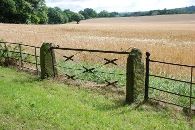 Beech lined avenue towards Banks Hall. A fine wrought iron fence runs along the avenue with wrought iron field gates between old stone pillars. A Curlew keens overhead and drops down into a field. The road turns at the private entrance to the Hall. Beside the road to the farm is a large walled garden with inverted arches on the bottom wall. The lower part of the garden is now a tarmacadamed yard but the upper
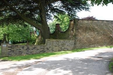 section is still being used as a kitchen garden. The footpath leads round the bottom of the extensive formal gardens of the Hall, which is a splendid Georgian country house. Charles Tiplady Pratt MA, vicar of Cawthorne, writing in the 1870s in his “History of Cawthorne”, states the Hall was previously called Micklethwaite or The Bank. It was the seat of one of the branches of the Greene family. Pratt records, “The Banks estate was sold about the middle of last century to Mr. Fawkes of Farnley, and was added by purchase to the Cannon Hall estate in 1826. Banks Hall has in the present century been the residence of Mr Thomas Wilson, Mr. Richard Thorp, and Mr. Thomas Ridley, of Northumberland, who tried the experiment of “gentleman-farming” there without much success. It was during the eleven years that it was occupied by Mr. Thomas Wilson, a man of conspicuous taste and ability, son of Mr. Daniel Wilson, of Barnby Furnace, that the grounds were laid out in their present form. After the heavy losses he suffered through unsuccessful mining operations, he was for many years connected with the Aire and Calder Navigation Company.” The house, which may now be a nursing home, has wonderful views over Banks Bottom, a valley with a strip of wood running along the bottom, and up towards Hoylandswaine. Swallows swoop over golden barley. The wheat has not fared so well, large patches have been flattened.
 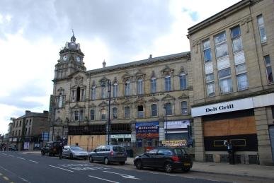 town first. Dewsbury has not suffered brutal “modernisation” of its centre that was inflicted on towns such as Barnsley and Pontefract in the mid 20th century. There are some pretty dire modern buildings around and some relatively sympathetic new areas, but many of the huge Victorian edifices remain, albeit in a number of cases, in a desperate condition. One massive mill, Cloth Hall Mills, has been restored into flats. The Machell Brothers, William and Robert, moved their Mungo and Shoddy manufacturing business from Bradford Road to this mill in 1874. Busts of the brothers, along with Disraeli and
 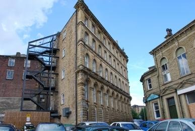 and now stands derelict. This magnificent building was designed by Holtom and Fox and opened in 1880. Departmental shops were housed on the ground floor; offices, a library and conversation rooms were on the first floor and a large industrial hall seating 1500 on the second floor. Around one of the upper floor windows is a decoration containing a depiction of a beehive, a symbol of success through toil. Behind this building is another tall, four storey edifice that tapers back at a sharp angle. Down the street are two arcades, Kingsway and Queensway, built in the early 20th century. Up a side street stands the Telephone Exchange, built in the same pale brown sandstone as the Victorian buildings, but with a decidedly art deco feel about it. Around the corner is No. 4 Grove Street, built as an auction house around 1870, before becoming a dance hall. It was then taken by Luke Howgate, a funeral furnisher, in the 1920s. Busts of Mr Fox, the auctioneer and Dr George Fearnley, the first mayor of Dewsbury are on the wall. Some of the street here are still cobbled with stone rather than tarmacadamed. Back towards the main road is the Longcauseway United Reform Church, the third consecrated building on this site, the first being built by a congregation of independents formed in 1814. The present building was erected in 1882-84 with a fine neo-gothic façade designed by Walter Hanstock of Batley.
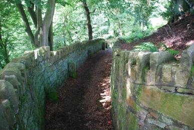 The road drops down to Lee Mills, which are now a combination of industrial units and “luxury” apartments. A track leads off past a large Victorian house which would have belonged to the mill owner or higher manager and then through fields. A young Rook stands on a drystone wall flicking its wings in a demand for food, which its parent obliges. Meadow Brown butterflies rest on brambles. The scut of a rabbit flashes white as it disappears through the long grasses of a meadow. The path comes to the edge of a wood, which according to the 1854 map is called Dobroyd. Here it drops steeply down between two walls. Far below is a large pond. Stone pillars with a hole drilled through stand down the path – I assume they once carried a railing. There are some very high steps down which are worrisome as they are damp. Over the wall is a stone bank that has been covered with dressed stone. This is falling away and the holes in the bank from rabbit warrens. A Great Spotted Woodpecker calls from the tall Beeches.
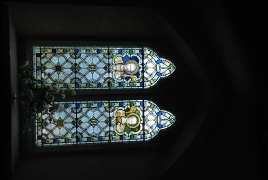
 Hand”. From the church the lane leads into Hepworth. The village suffered from the plagues of the 16th and 17th centuries. It is said that the Plague of London in 1665 came to Hepworth via cloth sent to Foster Place. Part of the village was barricaded and survived. The village hall has an extension standing on cast iron columns. There is a fine looking pub, The Butchers Arms, which is strangely “closed until further notice”. The Sports and Social Club is in a building that was the school (rebuilt in 1852). I retrace my steps. A road leads east into a hillside of newer housing, whilst westwards the road drops down to Dean Bridge. Old moss covered walls line the road, above banks of Foxgloves and the flat seed pods of Honesty. Dean Dike bubbles under the bridge and the road rises steeply again. Fields are bounded by falling drystone walls. A thin layer of soil covers the rock. Jackdaws are noisy and Swallows swoop low over the turf. The road brings me back into Scholes. The noise of children means it is playtime at the school but the bell starts to ring calling the pupils back to class.
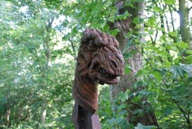 north linking with Swinton. The graveyard contains half a pit winding-wheel with a stone commemorating the Kilnhurst Colliery, 1858 to 1989 – “They Shall Not Be Forgotten”. An impressive monument marks the resting place of Samuel Broadhead, Late Treasurer of the Yorkshire Miners Association who died in 1897. The Yorkshire Miners Association joined with other associations on 26th November 1898 to form the Miners’ Federation of Great Britain, which, in turn, became the National Union of Mine Workers on 1st January 1945. Another grave records the brothers, Ben and James Spencer – Ben was killed at Thryberg Colliery in 1896 and James was drowned at Swinton in 1893.
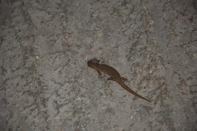 Kelk Gathering – Off to a little folk festival in the village of Little Kelk, which is a few miles inland from the east coast. It has been raining all day is is still coming down heavily as we set up our tent. It seems daft for both of us to get soaked, so I set the tent up on my own – and soaked I get! It is like a mini-Glastonbury with mud everywhere. The organisers have moved the whole thing into a barn – it is indeed a small festival – which we adjourn to after a couple of warm-up beers. There is a bar selling two excellent local ales and a sing-around in progress. This continues into the night. Kay mentions how this sort of thing, a few people in a barn with some ale, singing songs must have gone on for hundreds of years. A large black beetle scuttles across the floor, and a little later a newt makes slow progress across the ridged concrete.
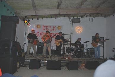 Saturday 14th July – Kelk Gathering – It has stopped raining. Dill the Dog (who has been discharged by the vet, her tail has healed well) and I head off down the road. Little Kelk is a row of houses down the lane. Maybe half a mile down the road is Great Kelk, a row of houses with a pub and chapel. In between are farms. A small wooden bus shelter has been used by Swallows as a nesting site. All that remains is an empty nest and a pile of droppings at the end of the bench. Greenfinches are in plentiful supply, several wheezing their song and it is pleasing to see several Tree Sparrows in the hedges. Several plum trees in gardens are laden with fruit. The music starts at one o’clock in the afternoon. Various performers produce first class sets – The Flivers are a splendid bunch (with the amazing Digby the Washboard man who was part of a jam session in Robin Hoods Bay last year), The 2 Johns play some very fundamentalist guitar and banjo, quite excellent, Dave and Zöe provide their usual superb set as the penultimate spot to be followed by a barn-storming electric set by the Duncan McFarlane Band.
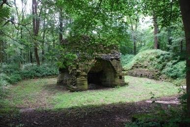 workings. The engine was supposed to have been moved to a mine in Chapeltown in 1870. Nearby is a rarity – a blast furnace. The technique of using a strong draught of air produced by a long chimney was introduced from the continent in 1496. The furnace was built sometime between 1698 and 1704 and smelted the local iron ore using charcoal from the woods. Lionel Copley had already built a new blast furnace some 500 yards to the west in 1652. On Lionel Copley’s death in 1675, his furnaces were run by a syndicate. The Fells became
 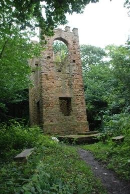 important members of the syndicate as did the Spencers of Cannon Hall who became major ironmasters. William Westby Cotton obtained the lease of the forge in 1726 and paid rent to the Earl of Strafford until 1741, when the furnace went out of use. Archaeological evidence shows that coke was used at some stage which may confirm the furnace was brought back into use for a short period in the 1790s. The stack with its inner lining of heat-resistant sandstone blocks remain, but the hearth and outer dressed stone facings have gone. The 1855 OS map shows the furnace standing in Smithy Wood. Warren Dike flows from the Birdwell direction, through the site and into Rockley Dike which flows from Rockley Dam to the west. Next to the stream there used to be a tree that was used by Lesser Spotted Woodpeckers for nesting. The last time I saw it much of the top had rotted away – now there is no sign of it at all. Tall spikes of purple-lipped flowers of Hedge Woundwort grow beside the path. By the stream are the straggly yellow flowers of Marsh Hawk’s Beard.
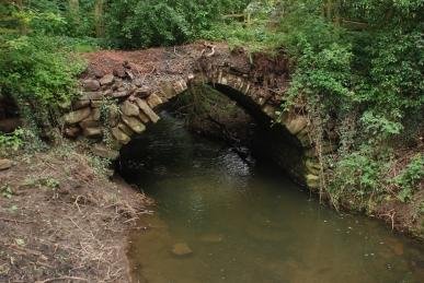 South Yorkshire. The first recorded Lord of Rockley appears to be Robertus in the reign of King John. It has been suggested (History of Worsbrough by J.E. Wilkinson c.1875) that Robert was the son of William who gave land at Worsbrough to the monks of Bretton Priory, and this William was Fitz-William, but there does not seem to be much evidence to support this. The Rockleys had large mortgages and surrendered the house to Thomas, Earl of Strafford, in 1726. There is a fine house of the 18th century here now. The track goes between a colourful garden and the Lower Rockley Dam, a lake with a large resident population of Mallard, Canada Geese and feral wildfowl. A modern iron bridge crosses the Rockley Dike. Beside it is the old arched-back stone bridge. Water has clearly risen some ten feet higher during the recent flooding as evidenced by debris in the bridge’s railings. Damage has been done to the banks below. By a gate there is a large clump of Woody Nightshade with yellow and purple flowers, bright red Poppies and pale pink thistles hosting “Bloodsuckers”, little red Soldier Beetles Rhagonycha fulva. Back at the road, a Chiffchaff sings and Linnets twitter on the overhead wires.
 Friday 27th July – Kilderee – We were told last night that it has rained every day for the last 55 days, but this morning is bright and sunny. Down through the farm and out across the fields. I am accompanied by Bruce, one of the farm dogs which enlivens Dill the Dog. The cattle look enquiringly at us. I have to negotiate an electric fence by releasing two springs, passing on and then reconnecting them. The crackle of electricity as I earth one of them whilst reconnecting it makes me a little uneasy. Swallows are sweeping across the fields. Hooded Crows stalk the ground seeking food. Beyond the second field is a broad shallow lake, red with extensive growths of Amphibious Bistort. A large flock of Lapwings is on the far side. A Grey Heron flies over the water. The field is scattered with yellow buttercups and the tiny bright blue eyes of Forget-me-nots. House and Sand Martins feed over the lake and Linnets and Pied Wagtails search the water’s edge. A Curlew keens in the distance as a flock of Black-headed Gulls fly in. The edge of the field is lined with Ox-eye Daisies, Great Knapweed, Red Clover and Lady’s Bedstraw.
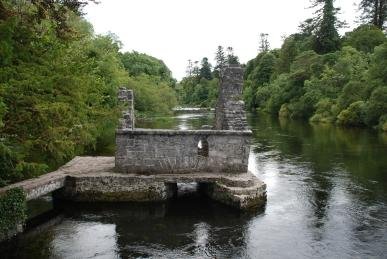 known mainly as the setting for the John Wayne film “The Quiet Man”. There are plenty of souvenirs of the film but there is much more to the village than this. The ruins of the Royal Abbey of Cong stand by the river built by the High King of Ireland, Turlach O’Connor in 1120 for the Augustinians. Stone carvings on the remaining pillars look, in some cases, to be restored as they are very sharp. A vine with bunches of grapes decorate one, whilst on another there is a little crudely carved face. A path leads to the river through a pair of arches. Over one is the head of Ruairi O’Connor, the last High King who became so weary of fighting the English that he retired here and spent the last fifteen years of his life, dying in 1198. The head was carved in the 19th century for a commission of Lord Ardilaun. By the river is a small ruined building that was a monk’s fishing hut. It is believed that the monks could let a net down through the floor and sit around a fire waiting for a catch. Indeed it is stated by some that there was a bell attached to the line that would ring to summon the fisherman when a catch was made. Over the river is a wood of fine trees including species from around the world planted by Lord Ardilaun. Beside the ruins is a new church, with a splendid stained glass window and the Twelve Stations of the Cross in white plaster relief on the back wall.
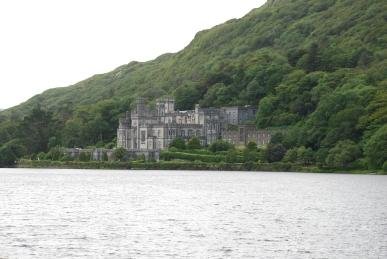 was in the news recently when the bridge across the river was washed away after torrential rain. This left an 80 km detour to get from one side of the village to the other. A temporary bridge had been erected by the time we arrived. Mountains loom over the village with exposed rocks glistening in the sun. We head down to Kylemore Abbey, the Monastic home of the Benedictine Order of Nuns in Ireland. The extraordinary building is a huge Victorian Gothic castle built between 1867 and 1871 by Mitchell Henry (English financier and MP for Galway). In 1903 the castle and land was bought by the Duke of Manchester. However, in 1913, their mortgage is foreclosed and in 1920 the Benedictine Nuns purchased the property. Unfortunately, we are too late to be able to see around the site. We drive back through the Maumturk Mountains, across desolate bogs between the steep slopes with cwms reminding one of their glacial origins.
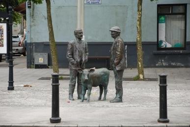 considerable number) often have displays of veterinary products as well as the usual fare. We have come mainly to get something for dinner and we have been told that the butcher in the main street is the best in the area. Looking at the quality of the beef joints in the window it seems like good advice. This is meat that has been well hung and with a superb marbling of fat. At the main junction in the high street is where the market used to be held. Now there are life-sized bronze statues of two farmers and a calf. It is also noticeable how many bars there are in the streets. The big pub conglomerates in England have driven small pubs out of business. Here they seem to be thriving. (Although at least three are up for sale in Williamstown where we were drinking last night.) Back near the edge of the shopping street is a gardening shop where Angela wants to look for some gardening tools. I wander over the river and through to a pretty riverside walk. The gardening shop has a large fountain operating in the water. A path leads off through a rotary stile and up the hill. In the wall of the base of the gardening shop are small square spaces. There is a nest in one, it looks like a Robin’s with brown spotted chicks, but when the parent arrives it is immediately clear it is much more exciting – a Spotted Flycatcher. I was commenting to Peter the other day when we were at the Yorkshire Sculpture Park that the woods there used to be a good site but I had not seen one for some years, and now there is nest just in front of me.
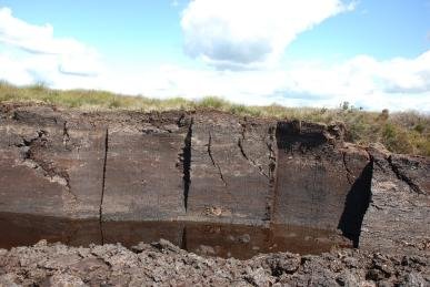 sits for a few moments on a bramble.
 The city takes its name from the Gaillimh river and was called Dún Bhun na Gaillimhe, or the “fort at the bottom of the Gaillimh”. The Galway fort was captured by the Norman Richard Mor de Burgh in the 1230s. Local merchants pushed
  for greater control over city affairs and this was gained completely in 1484 when the English Crown granted mayoral status. During the Middle Ages, Galway was ruled by an oligarchy of fourteen merchant families – the “tribes” of Galway. Christopher Columbus visited the city. Cromwell captured it in 1652 after a nine month seige. Galway supported the Jacobites against William of Orange and after its capture in 1691 by William, the great families were ruined and the city fell into decline. It was not until the last century that its fortunes really revived and Galway is now a vibrant and seemingly young city again. The river estuary has a large flock of Mute Swans on the far side. Large numbers of young people are enjoying the sun on the grass by the river. There is a large grey stone building houses Nimmos, a well-known restaurant. This is beside the Spanish Arch a remainder of a 16th century bastion, added to the town’s walls to protect merchant ships from looting. At this time, it was known as Ceann an Bhalla (Head of the Wall). Its current title dates from the last century – a reference to the former merchant trade with Spain, whose galleons often docked under its protection. Within the arches is a fireplace of 1602 showing the Lynch and Penrice coats of arms. Across the busy road, a street leads into the main shopping area.
 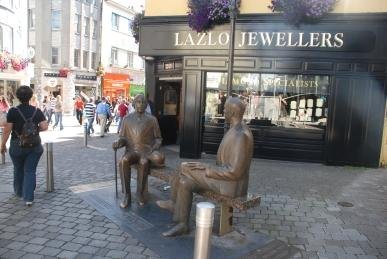 The spire of St Nicholas’ Anglican Church, the largest remaining medieval church in Ireland, rises over the buildings. The street is full of entertainers – musicians, human statues (who have the disconcerting habit of suddenly moving if you drop a coin into the bowl), puppeteers and even a belly-dancer. Another surprise is armed soldiers and police accompanying a
 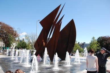 security van outside a bank. A life-size bronze of Oscar Wilde and the Estonian writer Eduard Wilde sitting together (although contemporaries, they never met) is in Shop Street, a gift from the Estonian city of Tartu commemorating Estonia’s joining the EU in 2004. The shopping area opens out into a great square and park, Eyre Square. Again, there are people everywhere, especially down Lower Abbeygate Street where hundreds are queuing for coaches to take them to the races. A single wall and window stands by the park. It comes from the house of one of the great merchants, Martin Browne, from a house erected in 1627 in Lower Abbeygate Street, now demolished. There is a large fountain with an abstract sculpture and numerous water jets. We wander around a bit, finding the County Hall with two black cannons in front of it. Then we head back down to the docks and sit in the sun.
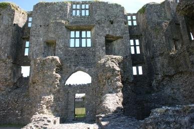
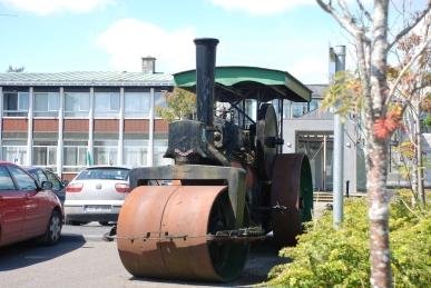 on stilts in a lake. This may have been the ancestral home of the O’Conors, Kings of Connacht. The castle was built by Robert de Ufford, Justiciar (Governor) of Ireland for Henry III. Work was started in 1269 but constant skirmishes with Aedh O’Conor, son of the king, Feilim O’Conor, held up progress and little was built by the early 1207s. Aedh died in 1274 and the raids greatly diminished and the first castle was probably finished by 1280. It was a quadrilateral building with four D-shaped towers in the corners. The castle was now the centre of Anglo-Norman power until the mid 14th century, when the O’Conors managed to take it. It was returned to the British Government by O’Conor Don in 1569 and then Government handed the building and 17,000 acres to Sir Nicholas Mailbie, an
 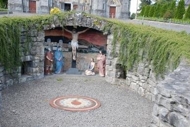 English soldier, in 1577. He turned the castle into a fortified house in the Renaissance style. Red Hugh O’Donnell attacked the castle and besieged it during the Nine Years War in 1596 and 1599. It was surrendered to Cromwell in 1652 and seems to have fallen into disuse a few years later. Swifts shriek has they scythe overhead. Hooded Crows alight at the top of pines.
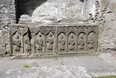 towards the Law Courts. Past numerous bars, including “Down the Hatch” and a fishmongers, something hardly ever seen in much of England now. Outside Courts is a car park and in it is parked a steam roller, apparently property of the County Council. Down the road is Sacred Heart Church. Built just over a century ago, it is a magnificent piece of ecclesiastical architecture. A tower rises high above the main body of the church with a smaller tower to the other side. It is all in grey stone. A gold and brightly coloured mosaic is over the door with statues of saints either side of the entrance. There are two alcoves high on the towers are strangely empty of saints. We sit inside in peace, looking at the beautiful stained glass and grandly ornate altar. Outside is a grotto depicting the Crucifixion. We continue down the street, popping into a bar for a pint of Guinness, and then on to the ruined Dominican Priory founded by Feilim O’Conor in 1253. The ruins are full of late 19th century graves, many in a poor condition. Near where the alter would have stood is a 13th century effigy of Feilim O’Conor on a later 15th century tomb. Eight mail-clad Gallowglasses, professional soldiers, are carved on the side of the tomb. Despite the 16th and 17th century suppressions, the last two survivors of the community were
  parish priests in 1830 and 1872.